
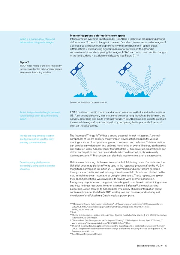
“onitoring ground deormations rom space “n‘A is a mappin tool of roun‚ “nterferometric synthetic aperture ra‚ar š“n‘A› is a techniŒue for mappin roun‚ ‚eformations usin ra‚ar imaesˆ ‚eformationsˆ o ‚etect chanes in the earth’s surface… to or more ra‚ar imaes of a select area are ta€en from approximately the same position in space… but at ‚ifferent timesˆ ”y bouncin sinals from a ra‚ar satellite off the roun‚ in successive orbits an‚ comparin the imaes… “n‘A can ‚etect even subtle chanes 2‡ in the lan‚ surface – up… ‚on or si‚eays šsee ˜iure ›ˆ Figure ” “n‘A maps rea‚ roun‚ ‚eformation by measurin reflecte‚ echo of ra‚ar sinals from an earth‰orbitin satellite ‘ource: ¤et •ropulsion ƒaboratory… NA‘Aˆ Active… but previously thouht ‚ormant… “n‘A has been use‚ to monitor an‚ analyse volcanos in Alas€a an‚ in the estern volcanos have been ‚iscovere‚ usin Ž‘ˆ A surprisin ‚iscovery as that some volcanos lon thouht to be ‚ormant… are “n‘Aˆ actually ‚eformin an‚ coul‚ eventually eruptˆ2† “n‘A can also be use‚ to estimate the overall ‚amae after an earthŒua€e by comparin built‰up areas before‰ an‚ after earthŒua€e eventsˆ 0 he “o can help ‚evelop location he “nternet of hins š“o› has a stron potential for ris€ mitiationˆ A central intellience an‚ be use‚ for early component of “o are sensors… mostly inbuilt ‚evices that can monitor various arnin communicationsˆ rea‚ins such as of temperature… roun‚ movement an‚ ra‚iationˆ his information can provi‚e early ‚etection an‚ onoin monitorin of events li€e fires… earthŒua€es an‚ ra‚iation lea€sˆ A recent stu‚y foun‚ that the –•‘ receivers in smartphones can ‚etect earthŒua€es an‚ can be use‚ to buil‚ cro‚source‚ earthŒua€e early arnin systemsˆ1 he sensors can also help locate victims after a catastropheˆ Cro‚sourcin platforms are ™nline cro‚sourcin platforms can also be helpful ‚urin crisesˆ ˜or instance… the 2 increasinly bein use‚ in ‚isaster Žshahi‚i crisis map platform as use‚ in the response proram after the Š 5ˆ„ situationsˆ manitu‚e earthŒua€e in žaiti in 2010ˆ “nformation an‚ reports ere athere‚ throuh social me‚ia an‚ text messaes sent via mobile phones an‚ plotte‚ on the map in real time by an international roup of volunteersˆ hese reports… alon ith their specific locations… ere available to anyone ith internet connectionˆ Emerency respon‚ers on the roun‚ soon bean to use them in ‚eterminin here an‚ ho to ‚irect resourcesˆ Another example is ‘afecast … a cro‚sourcin platform in ¤apan create‚ to furnish more availability of public information about contamination after the Šarch 2011 earthŒua€e an‚ tsunami… an‚ subseŒuent melt‚on of the ˜u€ushima ’aiichi nuclear poer plantˆ 28 “Šonitorin –roun‚ ’eformation from ‘pace”… Œ… ‰e‡artment of t€e InteriorŽŒ… ‘eological …urvey… ¤uly 2005… http://volcanoesˆussˆov/activity/metho‚s/insar/public½files/“n‘A½˜act½ ‘heet/2005‰025ˆp‚f 29 “bi‚ 30 he “o is a massive netor€ of heteroeneous ‚evices… mostly battery‰poere‚… an‚ interconnecte‚ via ireless netor€ interfacesˆ 31 “esearchers est ‘martphones for EarthŒua€e ¨arnin”… Œ… ‘eological …urvey… April 2015… http:// ˆussˆov/nesroom/articleˆasp¹“’¬„1‡†¾ˆ´Œ0Œe•5f2u„ 32 Žshahi‚i is a cro‚sourcin platform ‚evelope‚ to map of reports of post‰election violence in Ÿenya in 200‡ˆ he platform has since been use‚ in a rane of situations… inclu‚in the žaiti earthŒua€e of 2010ˆ ‘ee ˆushahi‚iˆcom 33 ‘ee http://safecastˆor/tilemap/ Swiss Re sigma No 1/2016 1†
 Natural Catastrophes And Man-Made Disasters In 2015 Page 19 Page 21